Verdant’s
Geographical Information Systems (GIS)
& Imaging Analysis Services
Applying advanced analysis technologies, Verdant experts provide valuable tools for supporting plantation partners in Estate Mapping and Plantation Evaluations.
1
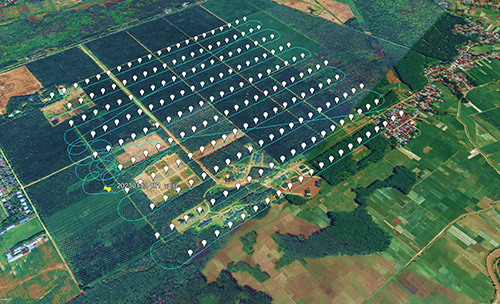
Flight Planning
View more
Flight Planning
Area of interest
Image resolution
Pictures overlap
Drone calibration
2
Image Acquisition
Image Acquisition
Field work
Monitoring flight mission and weather conditions
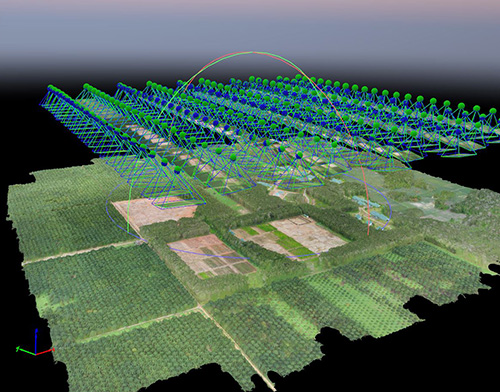
3
Image Processing
Image Processing
Pre processing QC
Determine tie points and matching points
Point cloud processing
Create photo mosaic
4
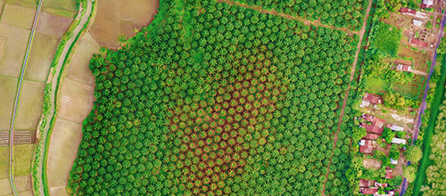
Digital Output
Digital Output
Digital orthophotos (TIFF, ECW, JPG)
DSM
5
Data Interpretation
Data Interpretation
Scoring
Input to geodatabase
6
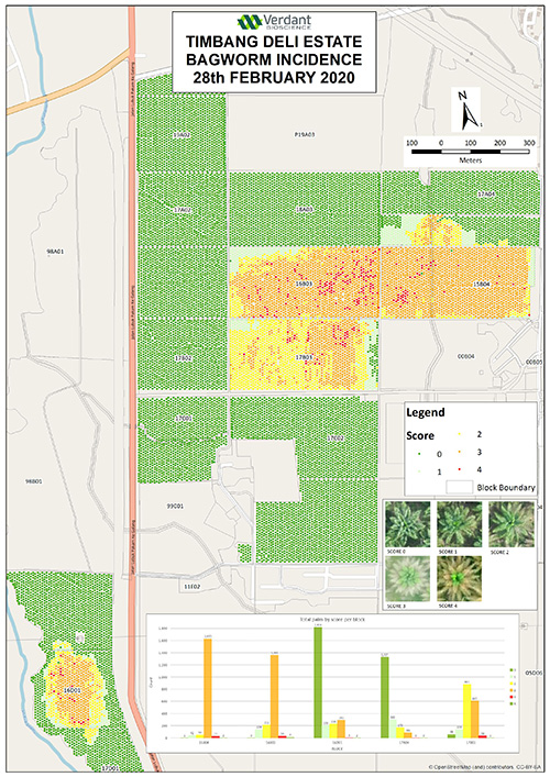
Result Delivery
Result Delivery
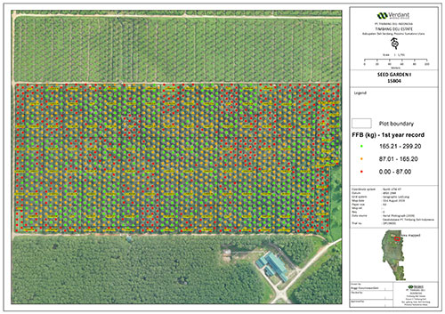
Aerial photographs
Scoring maps
Graphs
Flight Planning
Area of interest
Image resolution
Pictures overlap
Drone calibration
Image Acquisition
Field work
Monitoring flight mission and weather conditions
Image Processing
Pre processing QC
Determine tie points and matching points
Point cloud processing
Create photo mosaic
Digital Output
Digital orthophotos (TIFF, ECW, JPG)
DSM
Data Interpretation
Scoring
Input to geodatabase
Result Delivery
Aerial photographs
Scoring maps
Graphs
Verdant’s GIS systems combine several overlapping layers which incorporate maps with data, embracing soil type, elevation, slope and other plantation statistics. This facilitates the easy tracking of individual palms, together with vast land information.
Verdant Digital Imaging Analysis allows us to perform Palm Health evaluations, and the mapping of Pest & Disease Impacts by NDVI measurements (Normalized Difference Vegetal Index). This identifies and monitors changes using visible and multi-spectral bands via aerial photography image surveys.
Using extensive data, aerial photography, digital imaging analysis and thematical maps, Verdant experts perform Estate Evaluation Surveys to support plantations with Land Mapping, Individual Palm Counting and Health Data Recording, plus other information which helps optimize their Estate Design & Planning and the Mapping of Plantation Data.